I have to come to grips with the fact that I’m way out of shape. Before 2010, I had never hiked the Joice Trail in Santa Teresa County Park (STCP). While losing weight in 2010, I came to love that hill because it challenged me. My goal was to get to the top without stopping to catch my breath, and, in 2010 and 2011 I did just that. Today, I made it up with one stop. That, is a big improvement. Last autumn, I turned around well before the summit. Gaining 50 lbs. in 3 years will do that to you. So, I’m on the mend so to speak.

Red indicates my path…
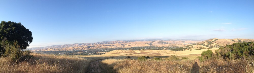
Today’s hike was a ~5 mile loop roaming through much of the park. The wind on the hillsides was stiff but refreshing. The sun only beat down on me during the last mile of the hike. The beautiful part of starting on the Joice Trail is that nothing on the rest of my hike is even remotely challenging after that. From the upper overlook on the trail you are afforded a spectacular view of Santa Clara County.

Santa Clara County from the Vista Loop
After the Joice Trail, my route turns to the Vista Loop. A short loop that can be addressed one of 2 ways: clockwise with a gradual incline and a steep downhill segment, or counterclockwise with a steep uphill bit and a gradual descent. I did counter.
The route rejoins the Joice Trail heading into the park with a very steep downhill segment. The path then turns right to go deeper into the park via the Bernal Hill Trail. This trail winds through some oak to connect with the Mine Trail.

The mine trail can take you either down towards the Norred stables or deeper into the park. Heading into the park you cross Bernal Road. After the crossing, the Mine Trail continues to the right, the Pueblo Trail to the left. The Mine Trail takes you up, then down into a valley with a small, normally dry, creek running through it. On previous hikes, I have seen wild pigs, coyotes and signs of mountain lions in this part of the park. Also, you can sometimes find wild artichokes growing off the trail. The Mine Trail comes to another junction in this small valley. The Stile Ranch Trail branches to the right and will take you on a very steep path. The Mine Trail goes uphill from here then down to the Fortini Trail junction. Continuing on the Mine Trail, you will then come to the Rocky Ridge Trail junction. Rocky Ridge lives up to it’s name and will take you the long way to Coyote Peak. We’ll save that for another day.

View From Mine Trail
From the junction, the Mine Trail continues to the left into the Pueblo Day Use Area. The route takes you past the large group picnic areas to finally connect with the Hidden Spring Trail. Going right will take you the short way up to Coyote Peak, but the car is another 2 miles to the left.
Hidden Spring Trail starts your descent out of the park. You can often find wild turkeys nesting under the oaks along the trail. The trail crosses the old Bernal Road along the way. The old roadway is slowly being claimed by the weeds and oaks. The trail will hit the junction of the Ohlone Trail before it hits Bernal Road. Across Bernal Road, the trail runs back into our old friend, the Mine Trail. This bit of the Mine Trail starts out dirt, but transitions into a steep asphalt downhill segment that can be murderous on the knees.
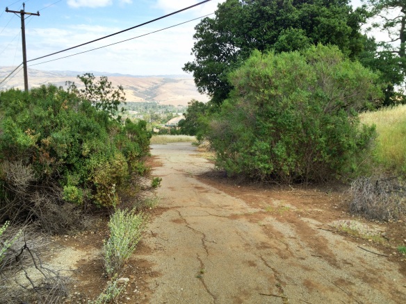
Old Bernal Road
Near the bottom of the Mine Trail, you will turn left onto the Norred Trail. The Norred Trail skirts the old Buck Norred Stables that now acts as a staging ground for county park vehicles and equipment. The trail takes one final uphill run just to get the heart pumping again before it settles into a gentle stroll on the side of the hill. At the end of the Norred trail you come back to the Joice Trail and a quick downhill to the starting point.